高德地图内置了许多遮盖物的api,今天主要就是讲解面的绘制方法
创建地图
为了更好的展示面的绘制,我们需要先创建一个地图对象
<body>
    <div id="container"></div>
</body>
     const map = window.map = new AMap.Map("container", {
        center: [116.381674, 39.910732],
        viewMode: "3D",
        zoom: 8,
      });
面的类型
高德地图提供了多种面的绘制类型,其中包括多边形Polygon,圆Circle,椭圆Ellipse,矩形Rectangle等
polygon类
多边形
    new AMap.Polygon({
      map,
      path: [
        [113.932241, 39.695409],
        [114.573982, 39.732067],
        [114.662936, 39.214627],
        [113.855994, 39.076651],
        [113.512885, 39.352332],
      ],
    });
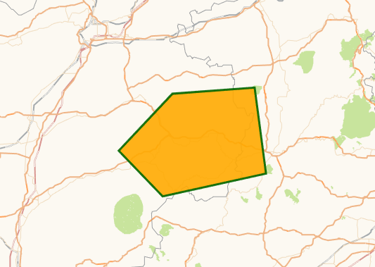
polygon 会自动头尾相连
更多属性
Circle类
圆
    new AMap.Circle({
      map,
      //圆心坐标
      center: [114.942465, 39.78421],
      //半径 单位米
      radius: 10000,
    });
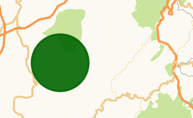
更多属性
CircleMarker类
圆点标记,属性和方法于Circle大体一致,区别为CircleMarker不随着地图级别变化发生大小改变,redius的单位为px
    new AMap.CircleMarker({
      map,
      //圆心坐标
      center: [114.288248,40.079622],
      //半径 单位 px
      radius: 20,
    });
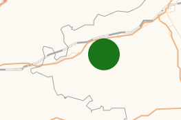
更多属性
Ellipse类
椭圆
   new AMap.Ellipse({
      map,
      //圆心坐标
      center: [114.394917,38.693466],
      //半径 单位 米
      radius: [10000, 20000] ,
    });
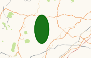
主要属性
- map:要显示该marker的地图对象
- center:椭圆的圆心位置
- radius: 椭圆的半径,用2个元素的数组表示,单位:米 。如: radius: [1000, 2000] 表示横向半径是1000,纵向的半径是2000。 默认值:[1000, 1000]
更多属性
Rectangle类
矩形
    new AMap.Rectangle({
      map,
      bounds: new AMap.Bounds([112.184897, 38.99885], [113.085776, 39.394758]),
    });
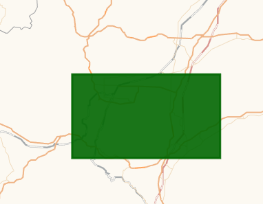
主要属性
- map:要显示该rectangle的地图对象
- bounds:矩形的范围
bounds属性接收的是一个bounds对象,该对象接收两个参数,第一个参数是物体西南顶点坐标,第二个参数是物体东北顶点坐标,也就是该例中矩形的左下角和右上角的坐标。
更多属性
全部代码展示 (其中xxxx 高德的秘钥,cccc是高德的key,需要自己申请)
<!DOCTYPE html>
<html>
  <head>
    <meta
      name="viewport"
      content="width=device-width initial-scale=1.0 maximum-scale=1.0 user-scalable=0"
    />
    <meta http-equiv="Content-Type" content="text/html; charset=utf-8" />
    <title>map</title>
    <style>
      body,
      html,
      #container {
        margin: 0;
        width: 100%;
        height: 100%;
      }
    </style>
  </head>

  <body>
    <div id="container"></div>
  </body>
  <script>
    window._AMapSecurityConfig = {
      securityJsCode: "xxxx",
    };
  </script>
  <script
    language="javascript"
    src="https://webapi.amap.com/maps?v=1.4.15&key=cccc"
  ></script>

  <script language="javascript">
    const map = (window.map = new AMap.Map("container", {
      center: [114.942465, 39.78421],
      viewMode: "3D",
      zoom: 8,
      showLabel: false,
    }));
    //--------------------------------------Polygon--------------------------------------
    new AMap.Polygon({
      map,
      path: [
        [113.932241, 39.695409],
        [114.573982, 39.732067],
        [114.662936, 39.214627],
        [113.855994, 39.076651],
        [113.512885, 39.352332],
      ],
    });

    //--------------------------------------Circle--------------------------------------
    new AMap.Circle({
      map,
      //圆心坐标
      center: [114.942465, 39.78421],
      //半径
      radius: 10000,
    });

    //--------------------------------------CircleMarker--------------------------------------
    new AMap.CircleMarker({
      map,
      //圆心坐标
      center: [114.288248, 40.079622],
      //半径 单位 px
      radius: 20,
    });

    //--------------------------------------Ellipse--------------------------------------
    new AMap.Ellipse({
      map,
      //圆心坐标
      center: [114.394917, 38.693466],
      //半径 单位 米
      radius: [10000, 20000],
    });

    //--------------------------------------Rectangle--------------------------------------
    new AMap.Rectangle({
      map,
      bounds: new AMap.Bounds([112.184897, 38.99885], [113.085776, 39.394758]),
    });


  </script>
</html>
最后
以上就是能干草莓最近收集整理的关于【高德地图入门】--- 绘制面的全部内容,更多相关【高德地图入门】---内容请搜索靠谱客的其他文章。
本图文内容来源于网友提供,作为学习参考使用,或来自网络收集整理,版权属于原作者所有。


发表评论 取消回复