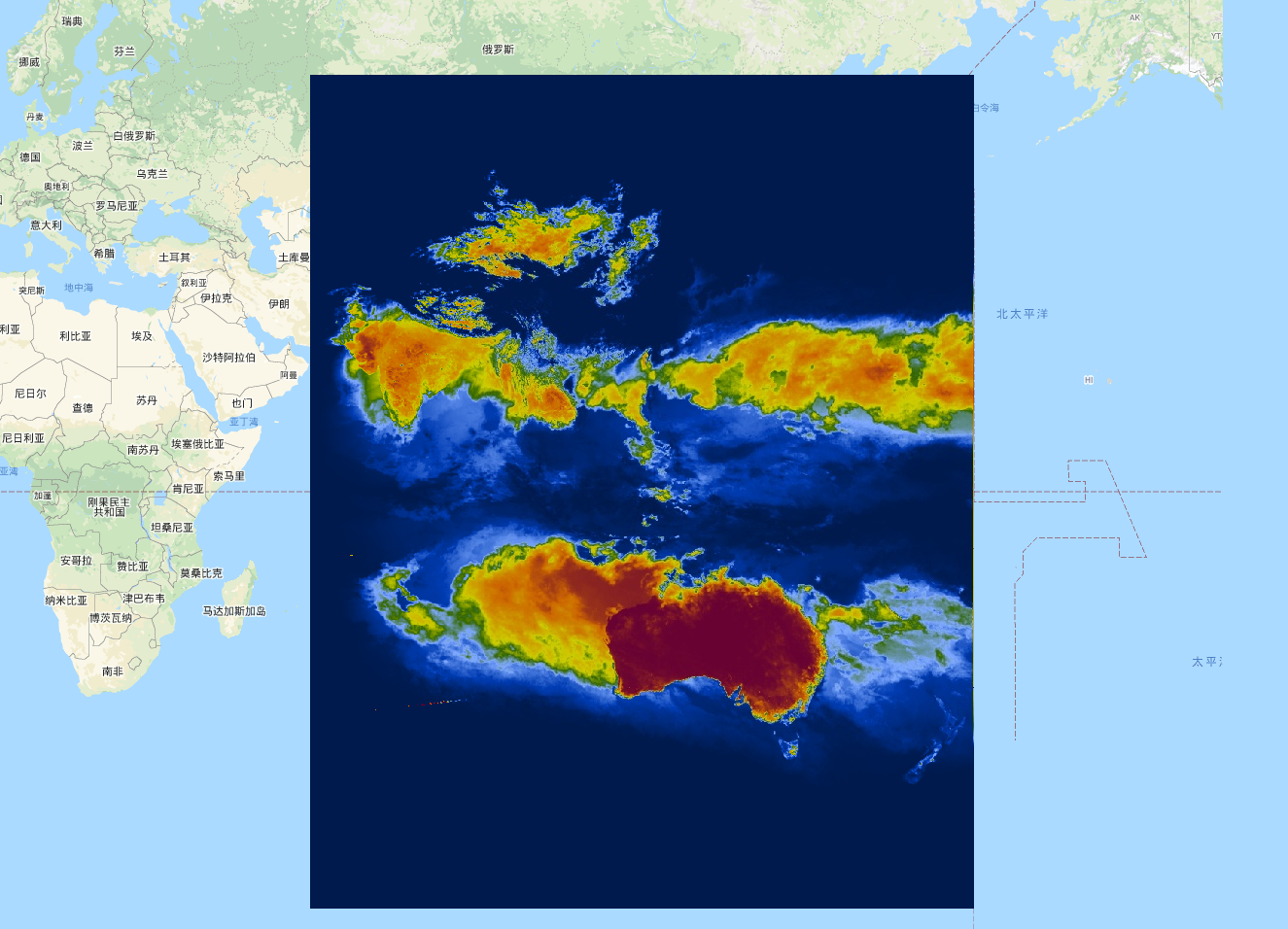
Keetch-Byram Drought Index (KBDI) is a continuous reference scale for estimating the dryness of the soil and duff layers. The index increases for each day without rain (the amount of increase depends on the daily high temperature) and decreases when it rains. This system is based primarily on recent rainfall patterns. It is a measure of meteorological drought; it reflects water gain or loss within the soil.
The scale ranges from 0 (no moisture deficit) to 800 (extreme drought). The range of the index is determined by assuming that there is 20 cm of moisture in a saturated soil that is readily available to the vegetation (Keetch and Byram, 1968). KBDI is world widely used for drought monitoring for national weather forecast, wildfire prevention and usefully especially in regions with rain-fed crops.
Keetch-Byram干旱指数(KBDI)是一个连续的参考量表,用于估计土壤和煤层的干燥程度。该指数在没有下雨的每一天都会增加(增加的数量取决于每日的最高温度),而在下雨的时候会减少。这个系统主要是基于最近的降雨模式。它是对气象干旱的测量;它反映了土壤内的水分增减。
等级范围从0(无水分缺失)到800(极端干旱)。该指数的范围是通过假设饱和土壤中有20厘米的水分可供植被使用而确定的(Keetch和Byram,1968)。KBDI被广泛用于国家天气预报的干旱监测、野火预防,特别是在有雨水灌溉作物的地区非常有用。
Dataset Availability
2007-01-01T00:00:00 - 2021-10-05T00:00:00
Dataset Provider
Institute of Industrial Science, The University of Tokyo, Japan
Collection Snippet
Copied
ee.ImageCollection("UTOKYO/WTLAB/KBDI/v1")
Resolution
4000 meters
Bands Table
| Name | Description | Min | Max |
|---|---|---|---|
| KBDI | Keetch-Byram Drought Index | 0 | 800 |
引用:
Wataru Takeuchi, Soni Darmawan, Rizatus Shofiyati, Mai Van Khiem, Kyaw San Oo, Uday Pimple and Suthy Heng, 2015. Near-real time meteorological drought monitoring and early warning system for croplands in Asia. 36th Asian conference on remote sensing (ACRS): Manila, Philippines, Oct. 20, 2015.
代码:
var collection = ee.ImageCollection('UTOKYO/WTLAB/KBDI/v1')
  .select('KBDI')
  .filterDate('2019-01-01', '2019-01-10');
var bandViz = {
  min: 0,
  max: 800,
  palette: [
    '001a4d', '003cb3', '80aaff', '336600', 'cccc00', 'cc9900', 'cc6600',
    '660033'
  ]
};
Map.addLayer(collection.mean(), bandViz, 'Keetch-Byram Drought Index');
Map.setCenter(120, 3, 3);

最后
以上就是忐忑硬币最近收集整理的关于Google Earth Engine——干旱指数(KBDI)是一个连续的参考量表,用于估计土壤和煤层的干燥程度。该指数在没有下雨的每一天都会增加(增加的数量取决于每日的最高温度)的全部内容,更多相关Google内容请搜索靠谱客的其他文章。


![matlab,二维向量,在[-π, π]之间随机旋转一个角度](https://www.shuijiaxian.com/files_image/reation/bcimg13.png)
发表评论 取消回复